Settlement Risk Assessment Mashhad Urban Railway Line 2 & 3
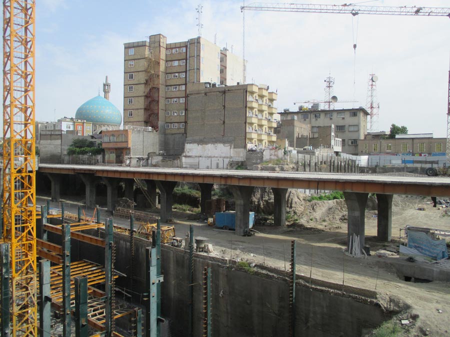
The Mashhad Urban Railway Line 2 and Mashhad Urban Railway Line 3 projects include the construction of respectively the 2nd and 3rd line for the metro network that facilitates passenger traffic in the city of Mashhad, Iran.
The two-track tunnel tube, both with a diameter of more than 9 meters, was excavated using a TBM with an earth pressure balance shield (EPB shield). The TBM drilled through stiff to hard clays with, especially in the western part of both lines, lenses consisting of sand and coarse to very coarse gravel with boulders.
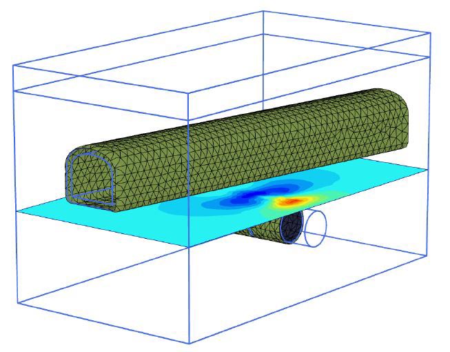
As part of the design of the tunnels, Arthe Civil & Structure carried out an evaluation of the settlements and the damage risks to buildings and infrastructure above ground during the tunnelling process of the TBM: a Settlement Risk Assessment (SRA).
Principle of the Settlement Risk Analysis
Ground deformations due to the tunnelling process may pose a threat for buildings and infrastructure objects. The amount of damage that may be induced depends on a combination of the settlement profile along the geometrical and structural characteristics of the building. It is good practice to conduct a Settlement Risk Assessment (SRA) prior to the start of a tunnelling project. Determination of settlements and ground displacement due to tunnelling and building response to these displacements is relatively complex and time consuming. Within project planning however, it is often required to obtain a quick overview of the possible risks related to settlement induced damage.
The power of GIS
Arthe Civil & Structure is able to set-up a high end system that can give a swift insight into the range of possible settlements and related risks.
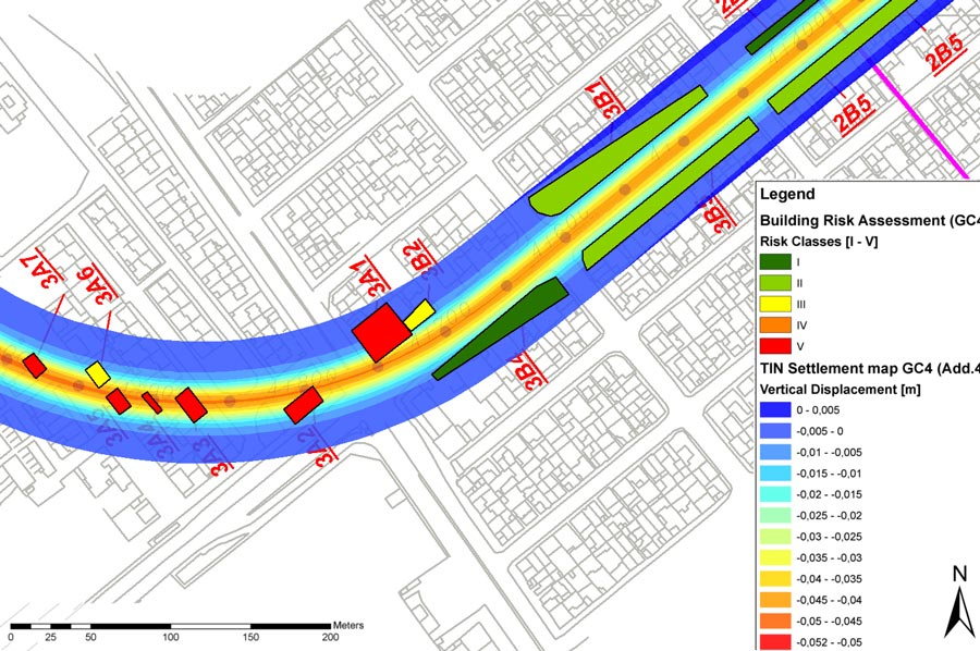
The SRA-system combines finite element modelling (FEM) and a geographical information system (GIS), and facilitates mapping of buildings along the route in different building- and damage classes. Combination of all information in the GIS, applying logical relations result in risk categories for each building and infrastructural object.
Through monitoring actual deformations that occur, the SRA database can be updated. If required, measures to prevent damage can be taken. The system was successfully applied for both the Mashhad Urban Railway Line 2 and Line 3 projects.
The GIS-based SRA-system is a state of the art tool that can play a major role in processing large amount of data to a number of simple, logical set of rules, in order to predict and control the building damage during a project.
For more information behind the Settlement Risk Assessment, please refer to the article that we have presented at the 11th Iranian Tunnelling Conference (ITC) in 2015.
Related Projects


